
Surrey Satellite Technology Ltd (SSTL) has today released the first Synthetic Aperture Radar (SAR) images taken from orbit by NovaSAR-1, a technology demonstration mission launched into a 580km sun-synchronous orbit on 16 September 2018.
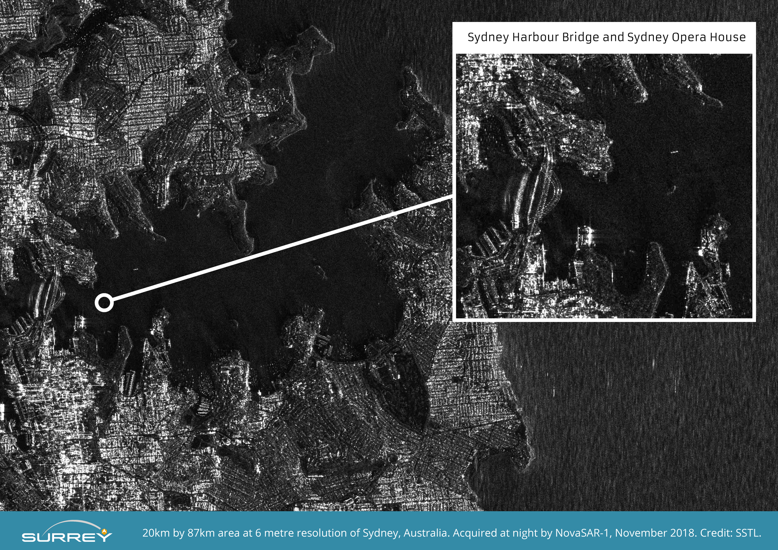
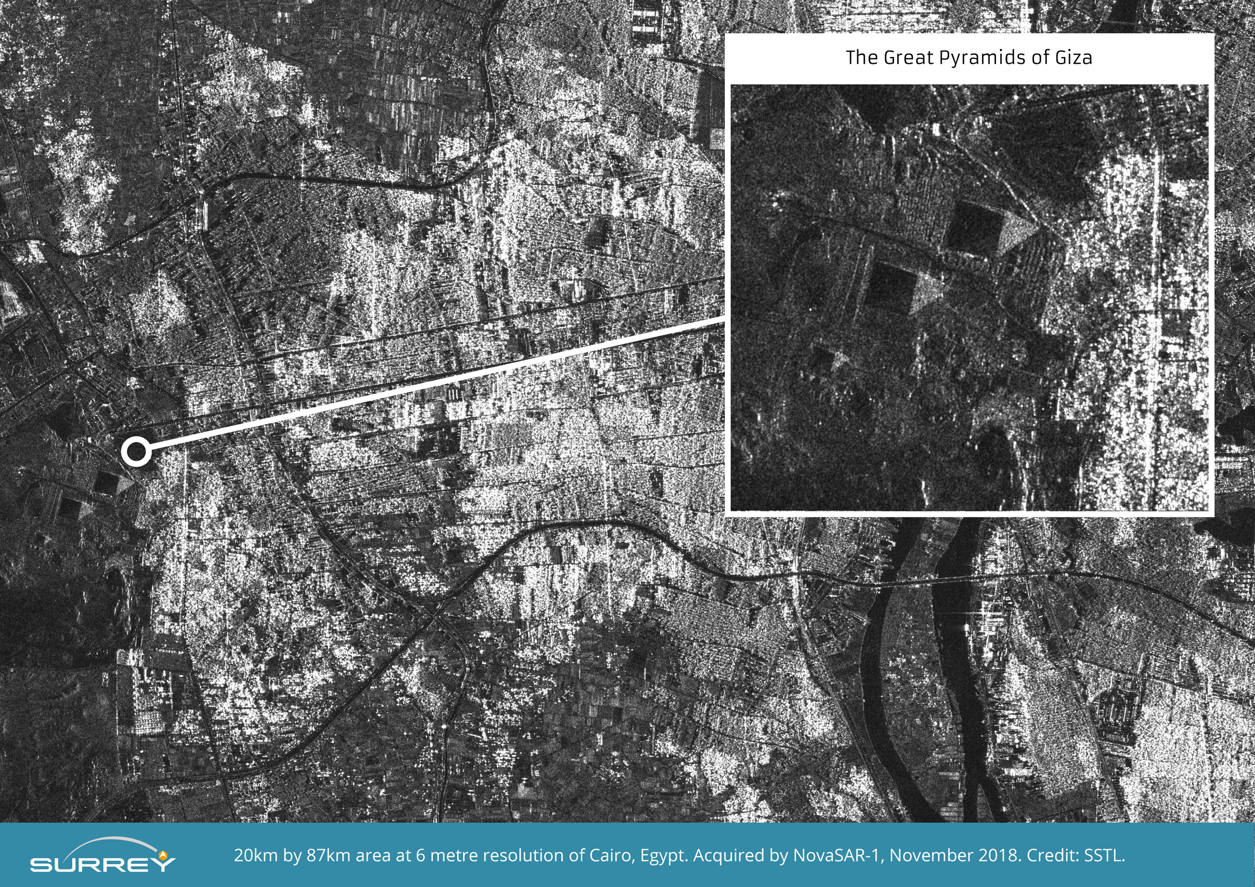
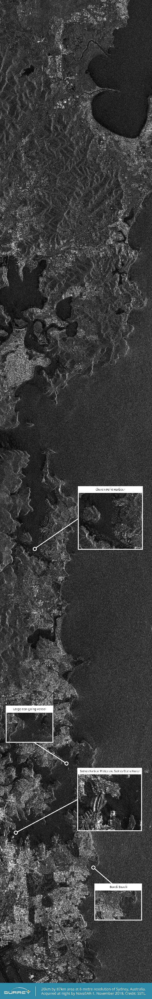
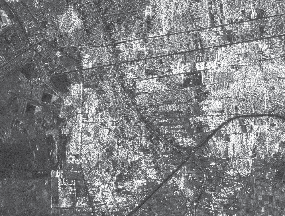
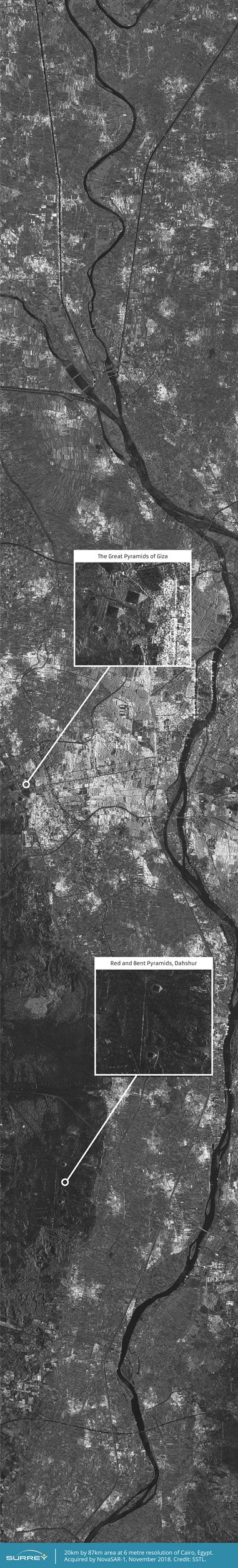
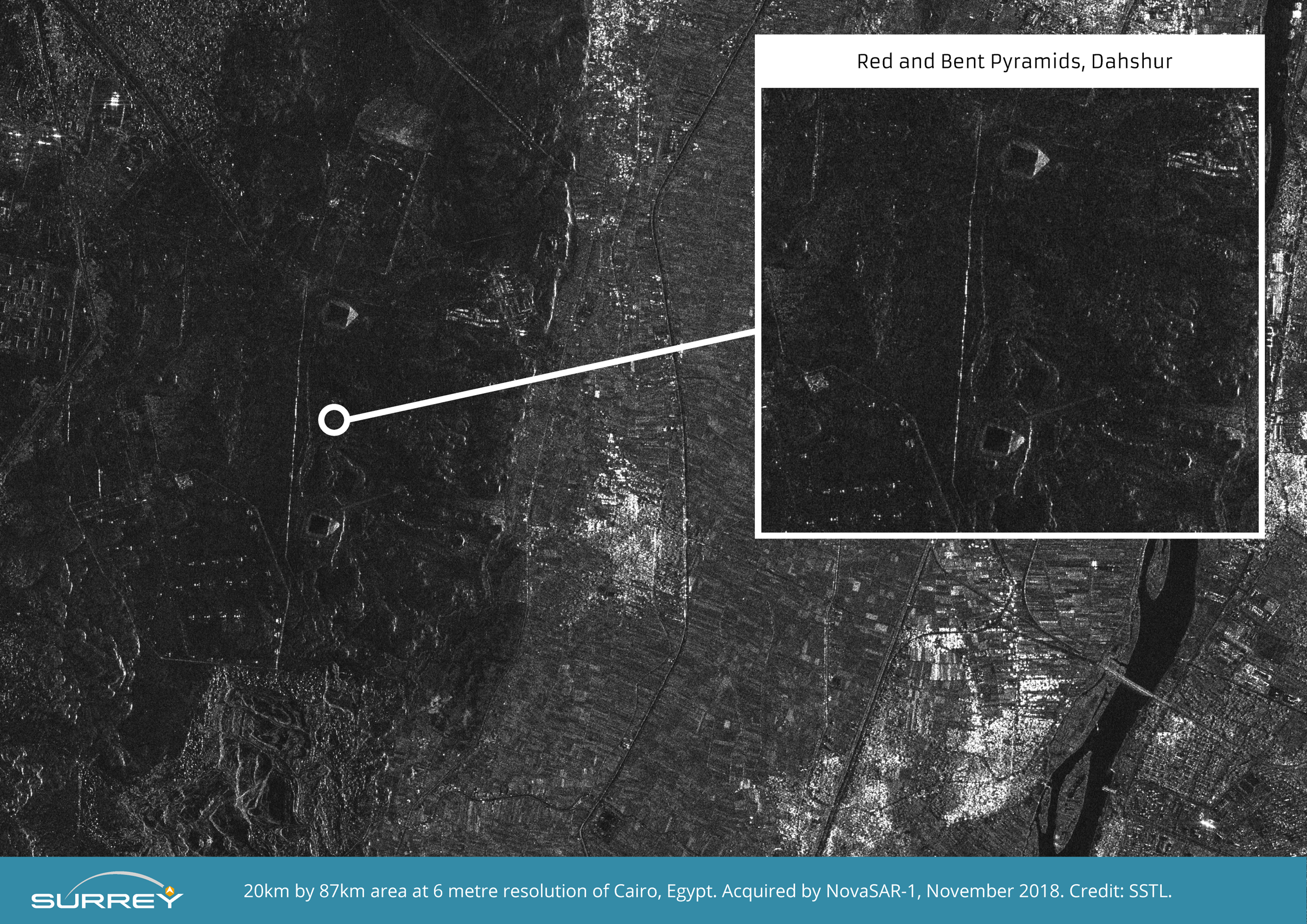
The S-Band SAR images released today have been acquired using the satellite’s stripmap mode at 6 metre resolution and are 20km wide by 87km long. They were taken over Sydney Harbour and Cairo and can be viewed and downloaded at the bottom of this page.
More images can be viewed and downloaded at the bottom of this page.
Sam Gyimah, the UK’s Science and Education Minister, visited SSTL today where he toured the Company’s satellite assembly and operations facilities, and viewed the new images from NovaSAR-1. The Minister said: “Yet again we can see UK research and innovation that is truly out of this world. This ‘eye in the sky’ can capture an image a dozen times wider than the Strait of Dover and the data it provides can help crack problems from illegal shipping to alerting us to damaging pollution that needs to be countered. This satellite, backed by a £21 million investment from the UK Government, is a great example of how we are working with the space sector through our modern Industrial Strategy to remain at the forefront of pioneering science and exploration.”
Andrew Cawthorne, Director of Earth Observation at SSTL said “We have worked closely with the SAR experts at Airbus in Portsmouth to develop NovaSAR-1 and the whole team is delighted with these first results - the outcome of space engineering expertise, ingenuity and collaboration. Over the coming weeks our spacecraft operators will continue to test the capabilities of the spacecraft as we task the satellite to image locations around the world, working towards the start of service delivery to our mission partners in the near future.”
Mission partners signed up for capacity from NovaSAR-1 include the UK Space Agency, Australia’s Commonwealth Scientific and Industrial Research Organisation (CSIRO), and the Indian Space Research Organisation (ISRO).
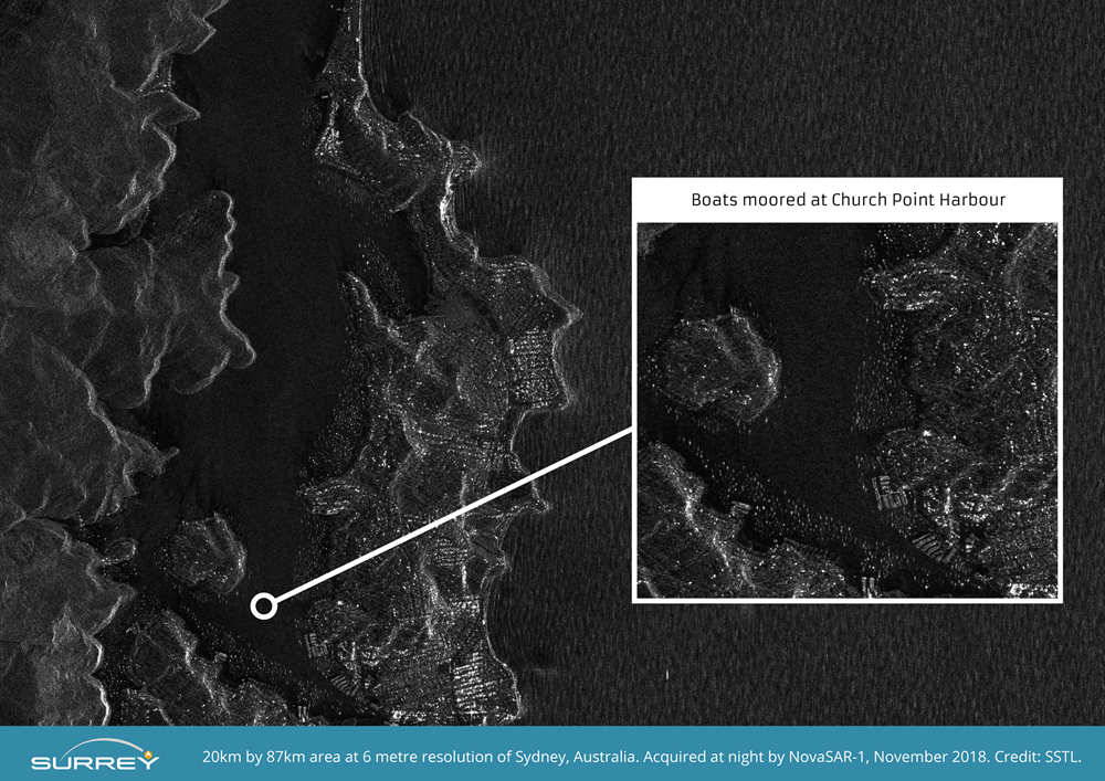
The image of Sydney was taken at night and cropped images taken from the original show Sydney Harbour Bridge, Sydney Opera House, The Royal Botanic Garden, Bondi beach and several boats crossing the harbour. A second close up from the original image shows small boats moored in the natural harbour at Church Point, north of Sydney in a demonstration of the usefulness of SAR for detecting vessels of many different sizes and types, particularly at night or through cloud cover.
The image of Cairo shows the River Nile flowing from Upper Egypt through Cairo and down towards Beni Suef. Urbanisation, cultivation along the Nile, and the non-irrigated desert areas are clearly distinguishable. Cropped images taken from the original show The Great Pyramids of Giza, and the Red Pyramid and Bent Pyramid near Dahshur.
Synthetic Aperture Radar is a powerful tool for monitoring the Earth from space due to its ability to see through clouds and image the Earth night and day, and NovaSAR-1 is the world’s first commercial SAR satellite to be operated at a 10:30 equator crossing time, providing time diversity for radar observations by affording increased daylight imaging opportunities in addition to night acquisitions.
NovaSAR-1 was designed and manufactured by SSTL, with an S-Band SAR payload developed by Airbus Defence and Space in Portsmouth and an Automatic Identification Receiver supplied by Honeywell Aerospace. The SAR payload has a dedicated maritime mode designed with a very wide swath area of 400km to enable the monitoring of the marine environment, and will provide direct radar ship detection information simultaneously with AIS ship tracking data to assist with the identification and tracking of sea-going vessels. In addition to operating in maritime mode, NovaSAR-1 has been optimised with three additional imaging modes, including a six metre resolution imaging mode, for a range of other applications such as flood monitoring and agricultural and forestry applications. The satellite has been designed to offer a high throughput of data, observing in a variety of polarisation combinations to add additional information to acquisitions in the form of ‘colour’.
NovaSAR-1 is operated in orbit from SSTL’s Spacecraft Operations Centre in Guildford UK.
ENDS
Notes to editors:
A full set of the images released today can be viewed and downloaded at the bottom of this page.
The images provided for download below have been compressed from the originals to reduce file sizes for viewing/download.
Press Contact:
Joelle Sykes, PR Manager, SSTL
Tel: +44 (0)1483 804243
Mob: 07775 000853
Email: j.sykes@sstl.co.uk
About SSTL
Surrey Satellite Technology Limited (SSTL) is the world's leading small satellite company, delivering operational space missions for a range of applications including Earth observation, science, communications, navigation, in-orbit servicing and beyond Earth infrastructure. The Company designs, manufactures and operates high performance satellites and ground systems for a fraction of the price normally associated with space missions, with 500 staff working on turnkey satellite platforms, space-proven satellite subsystems and optical instruments.
Since 1981, SSTL has built and launched more than 50 satellites for 20 international customers – as well as providing training and development programmes, consultancy services, and mission studies for ESA, NASA , international governments and commercial customers, with an innovative approach that is changing the economics of space.
Headquartered in Guildford, UK, SSTL is part of Airbus.
Download PDFImages

Download Hi-Res

Download Hi-Res
Download Hi-Res
Download Hi-Res

Download Hi-Res

Download Hi-Res