
New weather datasets, which could prove highly valuable for weather forecasting and for longer term climate monitoring, have just been made available from the Space GNSS Receiver-Remote Sensing Instrument (SGR-ReSI) instrument on board TechDemoSat-1, a small technology demonstration satellite launched by Surrey Satellite Technology Ltd (SSTL) in 2014.
With support from the European Space Agency, SSTL and the National Oceanography Centre (NOC) are continuing to work on the data received from TechDemoSat-1 and have been steadily improving the calibration of the measurements and researching new techniques and applications. New data, including delay Doppler maps and wind speed analysis over oceans, has been released on the website www.merrbys.org.
Looking to the future, the NASA CYGNSS mission due to launch later this year will fly 8 satellites carrying SSTL’s SGR-ReSI instrument, with the particular focus to measure the winds within cyclones, hurricanes and typhoons.
The SGR-ReSI instrument was developed by SSTL and is able to calculate TechDemoSat-1’s position and speed in much the same way as does a car-based SatNav, by measuring ranges and triangulating its position from high altitude GNSS satellites orbiting 20,000km above the satellite itself. The SGR-ReSI also carries a high gain nadir (downward-pointing) antenna to utilise a technique called GNSS reflectometry where the GNSS signals scattered off the Earth’s surface are collected and measured.
A calm ocean will give a clean reflection, whilst a rough, wind-driven ocean will spread the signal out. SSTL’s partner, the National Oceanography Centre in Southampton, has developed an algorithm that calculates from the signals the ocean roughness and in turn estimates the wind speed at the surface of the ocean. To validate the algorithm, NOC has compared the wind speed measurements from the SGR-ReSI against radar measurements from EUMETSAT’s MetOp satellite. These wind speed measurements are valuable for weather forecasting, and could also prove to be of significant benefit to the scientific community for climate monitoring.
The GNSS reflections off ice are much stronger than reflections off the ocean, and it has been possible to demonstrate from the results a new method for measuring the changing location of ice edges over time, and the potential for a new method of measuring ice height and thickness.
GPS reflections are not only collected by the SGR-ReSI over the ocean, but over land too where measurements to date show strong variations that could contain valuable geophysical information about the land surface. For instance, healthy vegetation will absorb more of the signal whilst damp soil can cause stronger reflections. Soil moisture is considered an essential parameter for climate monitoring, and is not currently measured with sufficient coverage over the globe.
TechDemoSat-1 was part-funded by Innovate UK and is jointly operated by SSTL in Guildford and by the Satellite Applications Catapult in Harwell.
SSTL received funding to support the development of the SGR-ReSI and ground processing from the UK CEOI, SEEDA, Innovate UK, and the European Space Agency.
The SGR-ReSI datasets can be accessed via www.merrbys.org
Videos which show the processing and application of the SGR-ReSI data are available on YouTube.
Video 1: https://youtu.be/RmjbM5bc1pE
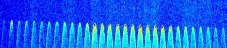
This video shows in about 20 times real time speed the motion of the TechDemoSat-1 satellite over an orbit, indicated by a white cross on the world map, together with measurements from the GNSS Reflectometry payload, the SGR-ReSI. The four specular GPS reflections targeted by the SGR-ReSI are shown by yellow spots, and the tracks of accumulated measurements are shown in yellow. The four Delay Doppler Map channels from the SGR-ReSI are shown under the map. The spreading parabola shape is caused by reflections being received away from the specular point, and a rougher ocean causes more spreading. When reflections are received from over land and over ice, there is much less spreading.
Video 2: https://youtu.be/hztM4mo8_bo
Data from the Space GNSS Receiver Remote Sensing Instrument on board TechDemoSat-1 has been used to produce GNSS reflections over the North West Passage between Greenland and Canada. The Delay Doppler Maps from the SGR-ReSI are superimposed upon a contemporary image of the state of the ice from the National Snow and Ice Data Centre (NSIDC), firstly when the channels are ice-free in September 2015, then in March 2015 when the ice is at a maximum. Reflections off ice are much stronger and less spread than over water, so it is possible to take measurements of the ice extent.
About SSTL
Surrey Satellite Technology Limited (SSTL) is the world's leading small satellite company, delivering operational space missions for a range of applications including Earth observation, science and communications. The Company designs, manufactures and operates high performance satellites and ground systems for a fraction of the price normally associated with space missions, with 450 staff working on turnkey satellite platforms, space-proven satellite subsystems and optical instruments.
Since 1981, SSTL has built and launched 47 satellites for 20 international customers – as well as providing training and development programmes, consultancy services, and mission studies for ESA, NASA , international governments and commercial customers, with an innovative approach that is changing the economics of space.
Headquartered in Guildford, UK, SSTL is part of the Airbus Group.
www.sstl.co.uk
Images

Download Hi-Res

Download Hi-Res